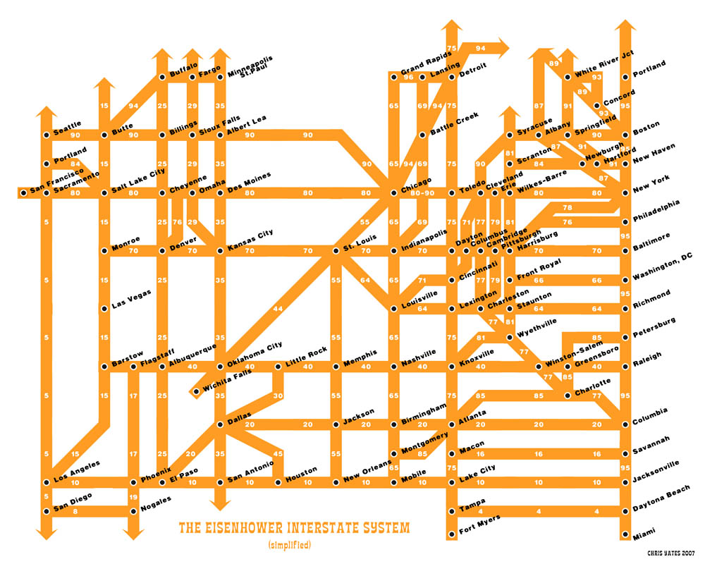
Here is a simplified map of the interstate system.
When I look at this map, my heart leaps, because it appears to be the solution to all of my interstate traveling problems (except the one where I don’t like to merge or switch lanes; that is still an issue). Regular maps bewilder me. There are so many different roads, and everything turns into something else and I can’t tell where one highway goes in a straight line because the map markings, they just don’t make any sense. Whereas this one makes everything so simple. How do I get to New York City? I go straight down I-10 and take a left on I-95, and BAM I am there!
Only at first I couldn’t believe it was that easy. I’ve seen atlases! I know what the road system looks like! And it isn’t this nice grid either! It’s all confusing and weird!
And then I realized that this interstate map is exactly like the Tube map of London: it doesn’t necessarily bear a huge resemblance to the street maps, but it is incredibly useful because you just follow the signs and you will pop up in the exact place where you want to be (or close enough to walk there). Which is why I love the Tube. If I get lost in London, I can just wander around until there appears a Tube station, and as soon as I walk down the stairs into the station, I’m no longer lost! I can get to anywhere then! Now America is like that for me too. All I need to do is find a major city, and I’m good to go.
I’m totally printing a copy of this map and going on a big cross-country road trip when I get home. Anyone want to come? I know where everything is now! We can just go wherever! THE WORLD IS SO SIMPLE NOW!
Subscribe to:
Post Comments (Atom)
1 comment:
I’ll come! You can pick me up in Princeton (get off at Philly and walk a few blocks).
(Seriously, I’ll totally come.)
Post a Comment